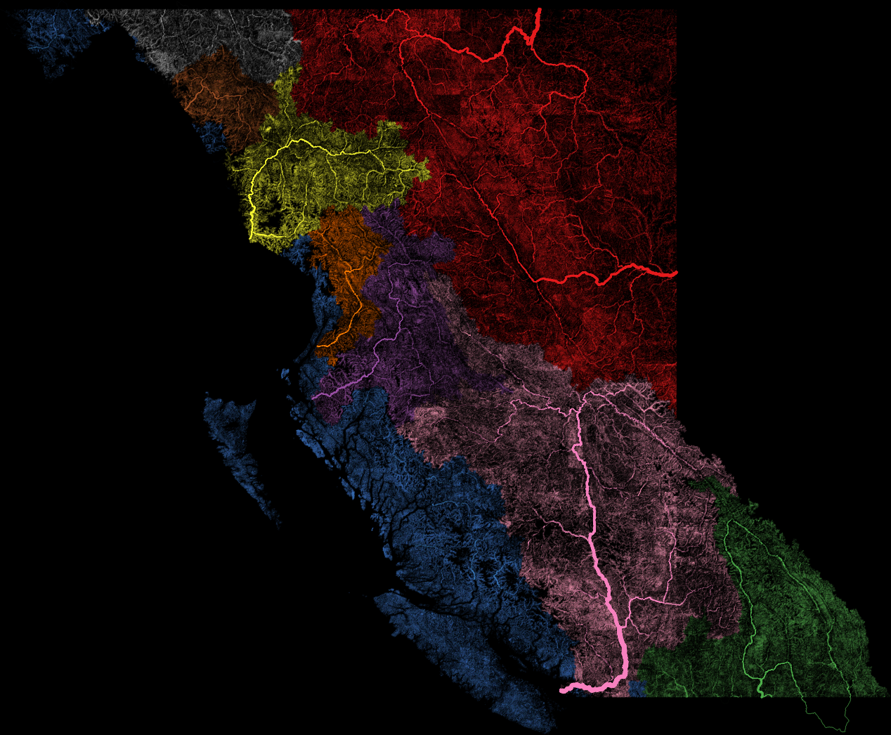
River basins of British Columbia colourized [1268x1046] [OC]
Posted Oct 25, 2016, 9:13 AM UTC
644
Posted Oct 25, 2016, 9:13 AM UTC
Good effort my friend, especially for a first try! That Canadian dataset is really hard to find, right? :-) If it exists at all.
Thanks!
Yeah, I spent pretty much an entire day working with the National Hydro Network dataset, which does at least include all the streams, but gave up. It doesn't include the watershed or stream order/magnitude data, and is too internally inconsistent to usefully calculate them - at least how I was trying to do it - without a lot of massaging that I don't know how to do.
Should petition the government to release a country-wide NHN with basin IDs and Strahler Stream Order Classification included! :)
I was inspired by u/Fejetlenfej's excellent River basins of the US to create a similar map for / including Canada. However I couldn't find a suitable dataset for the whole country (also it would be massive...) so stuck to my home province of BC.
This map shows the principal drainages in the province of British Columbia, as classified in the BC Freshwater Atlas.
All streams are shown, except those that do not have a classified drainage system at all; the line width is based on the Shreve magnitude (essentially the count of headwater streams that feed into it). Very small streams are much smaller than 1 pixel but contribute to colour density.
This is my first mapping project so go easy :). I learned a lot working on this map, from QGIS and PostGIS to stream magnitudes and how to calculate them in SQL (well, how to attempt to do so, anyway). A fun way to spend the weekend. I kind of knew the map might be a little boring with really only the Fraser being a major river here, and the Mackenzie that leaves us to Alberta, but it was a fun project anyway and I hope you enjoy.
Data: BC Freshwater Atlas
Tools: QGIS, PostGIS